 vesseltracker.com
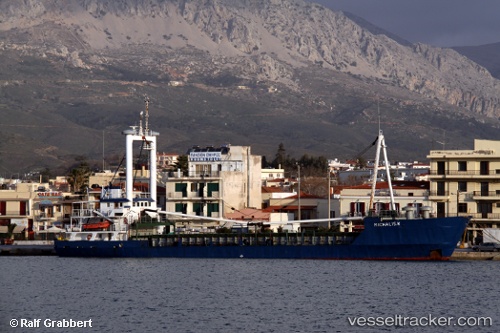
Vessel Michalis K IMO: 7707487, MMSI: 240581000 General Cargo Ship
UTC, 39.87167, 25.26333, course: -1, speed: 0
UTC, 39.87199, 25.26334, course: -1, speed: 0
2026-01-30 15:56:47 UTC, 39.72655, 25.15252, course: -1, speed: 6.5
Live AIS position:
UTC. Near Kontias Limnou),
updated 2026-01-30 15:56:47 UTC.
Find the position of the vessel Michalis K on the map. The latter are known coordinates and path.
marine traffic ship tracker show on live map
The current position of vessel Michalis K is 39.72655 lat / 25.15252 lng. Updated: 2026-01-30 15:56:47 UTCCurrently sailing under the flag of Greece
Michalis K built in 1977 year
Deadweight:
1281 tDetails:
Last coordinates of the vessel:
UTC, 39.87202, 25.26337, course: -1, speed: 0UTC, 39.87167, 25.26333, course: -1, speed: 0
UTC, 39.87199, 25.26334, course: -1, speed: 0
2026-01-30 15:56:47 UTC, 39.72655, 25.15252, course: -1, speed: 6.5