 vesseltracker.com
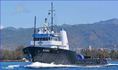
Vessel Nunui IMO: 7723625, MMSI: 367309910 Offshore Tug Supply Ship
UTC, 7.09500, 171.37167, course: -1, speed: 0
UTC, 7.09726, 171.37231, course: 71, speed: 0.1
UTC, 7.09726, 171.37231, course: 71, speed: 0.1
2026-02-07 10:42:52 UTC, 7.09726, 171.37231, course: 71, speed: 0.1
Live AIS position:
UTC. Near Majuro),
updated 2026-02-07 10:42:52 UTC.
Find the position of the vessel Nunui on the map. The latter are known coordinates and path.
marine traffic ship tracker show on live map
The current position of vessel Nunui is 7.09726 lat / 171.37231 lng. Updated: 2026-02-07 10:42:52 UTCDetails:
Last coordinates of the vessel:
UTC, 7.09500, 171.37167, course: -1, speed: 0UTC, 7.09500, 171.37167, course: -1, speed: 0
UTC, 7.09726, 171.37231, course: 71, speed: 0.1
UTC, 7.09726, 171.37231, course: 71, speed: 0.1
2026-02-07 10:42:52 UTC, 7.09726, 171.37231, course: 71, speed: 0.1