 vesseltracker.com
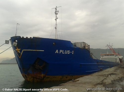
Vessel A Plus 1 IMO: 7811032, MMSI: 577271000 General Cargo Ship
UTC, 41.30522, 36.34035, course: 154, speed: 0
UTC, 41.30518, 36.34035, course: 153, speed: 0.7
2026-02-25 16:08:41 UTC, 41.30515, 36.34033, course: 153, speed: 0
Live AIS position:
UTC. Near Samsun),
updated 2026-02-25 16:08:41 UTC.
Find the position of the vessel A Plus 1 on the map. The latter are known coordinates and path.
marine traffic ship tracker show on live map
The current position of vessel A Plus 1 is 41.30515 lat / 36.34033 lng. Updated: 2026-02-25 16:08:41 UTCCurrently sailing under the flag of Vanuatu
A Plus 1 built in 1980 year
Deadweight:
3427 tDetails:
Last coordinates of the vessel:
UTC, 41.30515, 36.34032, course: 153, speed: 0UTC, 41.30522, 36.34035, course: 154, speed: 0
UTC, 41.30518, 36.34035, course: 153, speed: 0.7
2026-02-25 16:08:41 UTC, 41.30515, 36.34033, course: 153, speed: 0