 vesseltracker.com
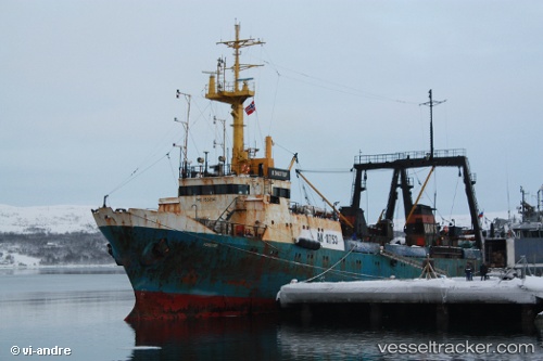
Vessel Brest IMO: 7832347, MMSI: 273298800 Fishing Vessel
UTC, 71.12333, 40.40333, course: -1, speed: 3
UTC, 70.95833, 40.23167, course: -1, speed: 3
2026-02-05 11:27:39 UTC, 70.88167, 40.22500, course: -1, speed: 1
Live AIS position:
UTC. 170 nm N of Ostrovnoy),
updated 2026-02-05 11:27:39 UTC.
Find the position of the vessel Brest on the map. The latter are known coordinates and path.
marine traffic ship tracker show on live map
The current position of vessel Brest is 70.88167 lat / 40.22500 lng. Updated: 2026-02-05 11:27:39 UTCCurrently sailing under the flag of Russia
Brest built in 1980 year
Deadweight:
901 tDetails:
Last coordinates of the vessel:
UTC, 71.21023, 40.44201, course: 186, speed: 4.1UTC, 71.12333, 40.40333, course: -1, speed: 3
UTC, 70.95833, 40.23167, course: -1, speed: 3
2026-02-05 11:27:39 UTC, 70.88167, 40.22500, course: -1, speed: 1