 vesseltracker.com
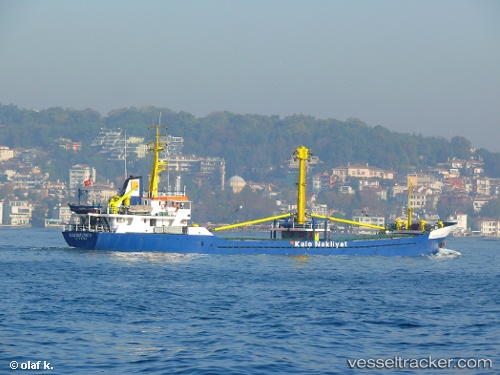
Vessel Kalenakliyat 2 IMO: 7901825, MMSI: 271002023 General Cargo Ship
UTC, 40.40323, 27.30722, course: -1, speed: 0
UTC, 40.40324, 27.30720, course: -1, speed: 0
2026-01-29 12:13:47 UTC, 40.40323, 27.30721, course: -1, speed: 0
Live AIS position:
UTC. Near Karabiga),
updated 2026-01-29 12:13:47 UTC.
Find the position of the vessel Kalenakliyat 2 on the map. The latter are known coordinates and path.
marine traffic ship tracker show on live map
The current position of vessel Kalenakliyat 2 is 40.40323 lat / 27.30721 lng. Updated: 2026-01-29 12:13:47 UTCCurrently sailing under the flag of Turkey
Kalenakliyat 2 built in 1980 year
Deadweight:
1092 tDetails:
Last coordinates of the vessel:
UTC, 40.47317, 27.52578, course: -1, speed: 7.8UTC, 40.40323, 27.30722, course: -1, speed: 0
UTC, 40.40324, 27.30720, course: -1, speed: 0
2026-01-29 12:13:47 UTC, 40.40323, 27.30721, course: -1, speed: 0