 vesseltracker.com
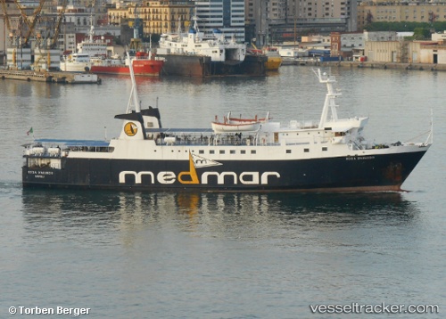
Vessel Rosa D Abundo IMO: 7911143, MMSI: 247049300 Passenger Ro Ro Cargo Ship
UTC, 40.82190, 14.11448, course: -1, speed: 0
UTC, 40.82190, 14.11448, course: -1, speed: 0
2026-02-14 15:50:44 UTC, 40.82190, 14.11448, course: -1, speed: 0
Live AIS position:
UTC. Near Pozzuoli),
updated 2026-02-14 15:50:44 UTC.
Find the position of the vessel Rosa D Abundo on the map. The latter are known coordinates and path.
marine traffic ship tracker show on live map
The current position of vessel Rosa D Abundo is 40.82190 lat / 14.11448 lng. Updated: 2026-02-14 15:50:44 UTCCurrently sailing under the flag of Italy
Rosa D Abundo built in 1981 year
Deadweight:
390 tDetails:
Last coordinates of the vessel:
UTC, 40.77467, 14.03633, course: -1, speed: 6.1UTC, 40.82190, 14.11448, course: -1, speed: 0
UTC, 40.82190, 14.11448, course: -1, speed: 0
2026-02-14 15:50:44 UTC, 40.82190, 14.11448, course: -1, speed: 0