 vesseltracker.com
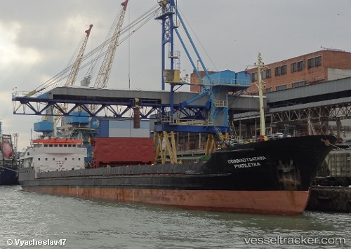
Vessel RAMTIN DARYA IMO: 7942910, MMSI: 422655600 General Cargo Ship
UTC, 37.51780, 49.46967, course: -1, speed: 0
UTC, 37.51780, 49.46967, course: -1, speed: 0
2026-02-18 21:04:04 UTC, 37.51780, 49.46967, course: -1, speed: 0
Live AIS position:
UTC. Near Bandar-e Anzali),
updated 2026-02-18 21:04:04 UTC.
Find the position of the vessel RAMTIN DARYA on the map. The latter are known coordinates and path.
marine traffic ship tracker show on live map
The current position of vessel RAMTIN DARYA is 37.51780 lat / 49.46967 lng. Updated: 2026-02-18 21:04:04 UTCCurrently sailing under the flag of Iran
RAMTIN DARYA built in 1981 year
Deadweight:
3134 tDetails:
Last coordinates of the vessel:
UTC, 39.55509, 49.86799, course: -1, speed: 5.5UTC, 37.51780, 49.46967, course: -1, speed: 0
UTC, 37.51780, 49.46967, course: -1, speed: 0
2026-02-18 21:04:04 UTC, 37.51780, 49.46967, course: -1, speed: 0