 vesseltracker.com
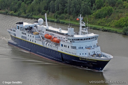
Vessel N G Explorer IMO: 8019356, MMSI: 309336000 Cruise Ship
UTC, -62.29064, -59.30756, course: 332, speed: 11.4
UTC, -62.05004, -59.58811, course: 334, speed: 9.4
2026-02-09 15:29:52 UTC, -62.05004, -59.58811, course: 334, speed: 9.4
Live AIS position:
UTC. 20 nm NW of Bellingshausen),
updated 2026-02-09 15:29:52 UTC.
Find the position of the vessel N G Explorer on the map. The latter are known coordinates and path.
marine traffic ship tracker show on live map
The current position of vessel N G Explorer is -62.05004 lat / -59.58811 lng. Updated: 2026-02-09 15:29:52 UTCCurrently sailing under the flag of Bahamas
N G Explorer built in 1982 year
Deadweight:
1301 tDetails:
Last coordinates of the vessel:
UTC, -62.37333, -58.87167, course: -1, speed: 10UTC, -62.29064, -59.30756, course: 332, speed: 11.4
UTC, -62.05004, -59.58811, course: 334, speed: 9.4
2026-02-09 15:29:52 UTC, -62.05004, -59.58811, course: 334, speed: 9.4