 vesseltracker.com
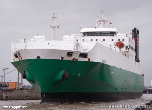
Vessel JABAL ALI 9 IMO: 8020604, MMSI: 341475000 Ro-Ro Cargo Ship
UTC, 18.84179, 72.75337, course: -1, speed: 8.6
UTC, 18.85870, 72.35911, course: -1, speed: 9.3
2026-03-01 17:35:47 UTC, 18.90222, 72.06954, course: 271, speed: 9.7
Live AIS position:
UTC. 41 nm W of Air Parcel Sorting Office/Mumbai),
updated 2026-03-01 17:35:47 UTC.
Find the position of the vessel JABAL ALI 9 on the map. The latter are known coordinates and path.
marine traffic ship tracker show on live map
The current position of vessel JABAL ALI 9 is 18.90222 lat / 72.06954 lng. Updated: 2026-03-01 17:35:47 UTCCurrently sailing under the flag of St.Kitts and Nevis
JABAL ALI 9 built in 1983 year
Deadweight:
13090 tDetails:
Last coordinates of the vessel:
UTC, 18.93703, 72.84285, course: 173, speed: 0UTC, 18.84179, 72.75337, course: -1, speed: 8.6
UTC, 18.85870, 72.35911, course: -1, speed: 9.3
2026-03-01 17:35:47 UTC, 18.90222, 72.06954, course: 271, speed: 9.7