 vesseltracker.com
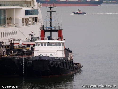
Vessel Island Tugger IMO: 8104101, MMSI: 316015269 Tug
UTC, 49.22333, -124.81333, course: -1, speed: 0
UTC, 49.22333, -124.81333, course: -1, speed: 0
2026-02-05 22:49:08 UTC, 49.22333, -124.81333, course: -1, speed: 0
Live AIS position:
UTC. Near PORT ALBERNI),
updated 2026-02-05 22:49:08 UTC.
Find the position of the vessel Island Tugger on the map. The latter are known coordinates and path.
marine traffic ship tracker show on live map
The current position of vessel Island Tugger is 49.22333 lat / -124.81333 lng. Updated: 2026-02-05 22:49:08 UTCDetails:
Last coordinates of the vessel:
UTC, 49.22415, -124.81423, course: 332, speed: 0UTC, 49.22333, -124.81333, course: -1, speed: 0
UTC, 49.22333, -124.81333, course: -1, speed: 0
2026-02-05 22:49:08 UTC, 49.22333, -124.81333, course: -1, speed: 0