 vesseltracker.com
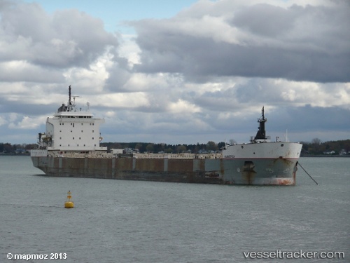
Vessel Kaministiqua IMO: 8119285, MMSI: 316009457 Bulk Carrier
UTC, 42.98583, -82.41653, course: 342, speed: 0
UTC, 42.98500, -82.41667, course: -1, speed: 0
2026-02-10 17:56:49 UTC, 42.98500, -82.41667, course: -1, speed: 0
Live AIS position:
UTC. Near Port Huron),
updated 2026-02-10 17:56:49 UTC.
Find the position of the vessel Kaministiqua on the map. The latter are known coordinates and path.
marine traffic ship tracker show on live map
The current position of vessel Kaministiqua is 42.98500 lat / -82.41667 lng. Updated: 2026-02-10 17:56:49 UTCCurrently sailing under the flag of Canada
Kaministiqua built in 1983 year
Deadweight:
36245 tDetails:
Last coordinates of the vessel:
UTC, 42.97978, -82.41540, course: 347, speed: 1.3UTC, 42.98583, -82.41653, course: 342, speed: 0
UTC, 42.98500, -82.41667, course: -1, speed: 0
2026-02-10 17:56:49 UTC, 42.98500, -82.41667, course: -1, speed: 0