 vesseltracker.com
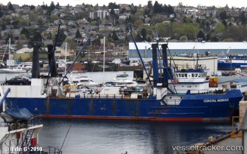
Vessel Coastal Nomad IMO: 8213249, MMSI: 303683000 General Cargo Ship
UTC, 53.83603, -166.58644, course: 33, speed: 0
UTC, 53.83603, -166.58643, course: 31, speed: 0
2026-02-01 09:54:40 UTC, 53.83604, -166.58643, course: 31, speed: 0
Live AIS position:
UTC. Near Dutch Harbor),
updated 2026-02-01 09:54:40 UTC.
Find the position of the vessel Coastal Nomad on the map. The latter are known coordinates and path.
marine traffic ship tracker show on live map
The current position of vessel Coastal Nomad is 53.83604 lat / -166.58643 lng. Updated: 2026-02-01 09:54:40 UTCCurrently sailing under the flag of USA
Coastal Nomad built in 1983 year
Deadweight:
2881 tDetails:
Last coordinates of the vessel:
UTC, 53.83602, -166.58644, course: 31, speed: 0UTC, 53.83603, -166.58644, course: 33, speed: 0
UTC, 53.83603, -166.58643, course: 31, speed: 0
2026-02-01 09:54:40 UTC, 53.83604, -166.58643, course: 31, speed: 0