 vesseltracker.com
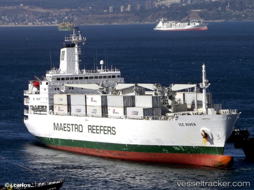
Vessel ICE RIVER IMO: 8311118, MMSI: 311001077 Refrigerated Cargo Ship
UTC, 22.66453, 113.75119, course: 354, speed: 14
2026-01-26 19:32:53 UTC, 22.66453, 113.75119, course: 354, speed: 14
Live AIS position:
UTC. Near Fuyong),
updated 2026-01-26 19:32:53 UTC.
Find the position of the vessel ICE RIVER on the map. The latter are known coordinates and path.
marine traffic ship tracker show on live map
The current position of vessel ICE RIVER is 22.66453 lat / 113.75119 lng. Updated: 2026-01-26 19:32:53 UTCCurrently sailing under the flag of Bahamas
ICE RIVER built in 1985 year
Deadweight:
14519 tDetails:
Last coordinates of the vessel:
UTC, 22.66453, 113.75119, course: 354, speed: 14.6UTC, 22.66453, 113.75119, course: 354, speed: 14
2026-01-26 19:32:53 UTC, 22.66453, 113.75119, course: 354, speed: 14