 vesseltracker.com
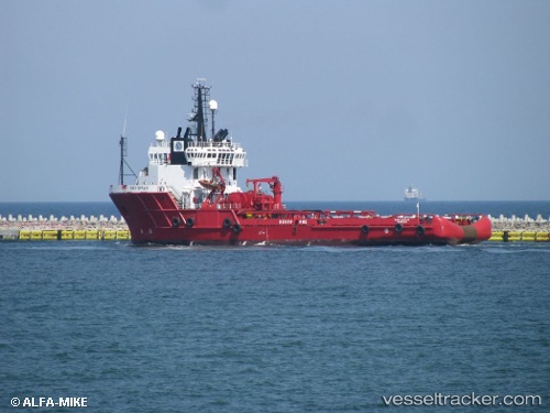
Vessel ARTEMIS IMO: 8321591, MMSI: 241813000 Offshore Tug/Supply Ship
UTC, 38.05167, 20.70833, course: -1, speed: 0
UTC, 38.05190, 20.70955, course: -1, speed: 0.1
2026-02-28 21:17:33 UTC, 38.04667, 20.73667, course: -1, speed: 3
Live AIS position:
UTC. Near POROS KEFALONIA),
updated 2026-02-28 21:17:33 UTC.
Find the position of the vessel ARTEMIS on the map. The latter are known coordinates and path.
marine traffic ship tracker show on live map
The current position of vessel ARTEMIS is 38.04667 lat / 20.73667 lng. Updated: 2026-02-28 21:17:33 UTCCurrently sailing under the flag of Greece
ARTEMIS built in 1984 year
Deadweight:
2190 tDetails:
Last coordinates of the vessel:
UTC, 38.10200, 20.83378, course: -1, speed: 10.5UTC, 38.05167, 20.70833, course: -1, speed: 0
UTC, 38.05190, 20.70955, course: -1, speed: 0.1
2026-02-28 21:17:33 UTC, 38.04667, 20.73667, course: -1, speed: 3