 vesseltracker.com
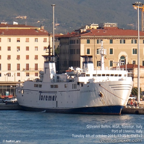
Vessel G.bellini IMO: 8402357, MMSI: 247041900 Passenger Ro Ro Cargo Ship
UTC, 42.70237, 10.43062, course: 52, speed: 14.6
UTC, 42.81593, 10.43110, course: 0, speed: 0
2026-02-17 15:58:10 UTC, 42.92843, 10.56292, course: 215, speed: 12.9
Live AIS position:
UTC. Near Porto Vecchio Di Piombino),
updated 2026-02-17 15:58:10 UTC.
Find the position of the vessel G.bellini on the map. The latter are known coordinates and path.
marine traffic ship tracker show on live map
The current position of vessel G.bellini is 42.92843 lat / 10.56292 lng. Updated: 2026-02-17 15:58:10 UTCCurrently sailing under the flag of Italy
G.bellini built in 1985 year
Deadweight:
474 tDetails:
Last coordinates of the vessel:
UTC, 42.58990, 10.09897, course: 357, speed: 0UTC, 42.70237, 10.43062, course: 52, speed: 14.6
UTC, 42.81593, 10.43110, course: 0, speed: 0
2026-02-17 15:58:10 UTC, 42.92843, 10.56292, course: 215, speed: 12.9