 vesseltracker.com
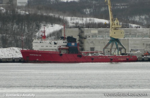
Vessel Puerto Argentino IMO: 8418514, MMSI: 701829000 Offshore Tug Supply Ship
UTC, -59.37561, -62.36216, course: -1, speed: 8.9
UTC, -59.58618, -62.14084, course: -1, speed: 8.9
2026-02-05 06:20:33 UTC, -59.87977, -61.86529, course: -1, speed: 8
Live AIS position:
UTC. 162 nm NW of Bellingshausen),
updated 2026-02-05 06:20:33 UTC.
Find the position of the vessel Puerto Argentino on the map. The latter are known coordinates and path.
marine traffic ship tracker show on live map
The current position of vessel Puerto Argentino is -59.87977 lat / -61.86529 lng. Updated: 2026-02-05 06:20:33 UTCDetails:
Last coordinates of the vessel:
UTC, -59.10146, -62.60756, course: -1, speed: 8.5UTC, -59.37561, -62.36216, course: -1, speed: 8.9
UTC, -59.58618, -62.14084, course: -1, speed: 8.9
2026-02-05 06:20:33 UTC, -59.87977, -61.86529, course: -1, speed: 8