 vesseltracker.com
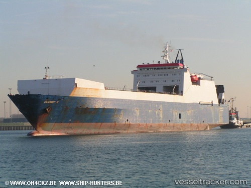
Vessel Ulusoy 5 IMO: 8501464, MMSI: 271000426 Ro Ro Cargo Ship
UTC, 48.30150, -6.35409, course: 222, speed: 11.4
UTC, 47.96387, -6.61634, course: 205, speed: 11.9
2026-02-13 09:40:47 UTC, 47.68664, -6.84833, course: 210, speed: 11.8
Live AIS position:
UTC. 50 nm S of San Clodio),
updated 2026-02-13 09:40:47 UTC.
Find the position of the vessel Ulusoy 5 on the map. The latter are known coordinates and path.
marine traffic ship tracker show on live map
The current position of vessel Ulusoy 5 is 47.68664 lat / -6.84833 lng. Updated: 2026-02-13 09:40:47 UTCCurrently sailing under the flag of Turkey
Ulusoy 5 built in 1987 year
Deadweight:
14103 tDetails:
Last coordinates of the vessel:
UTC, 48.67553, -5.97515, course: 210, speed: 11.8UTC, 48.30150, -6.35409, course: 222, speed: 11.4
UTC, 47.96387, -6.61634, course: 205, speed: 11.9
2026-02-13 09:40:47 UTC, 47.68664, -6.84833, course: 210, speed: 11.8