 vesseltracker.com
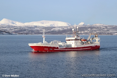
Vessel Vestviking IMO: 8512102, MMSI: 258381000 Fishing Vessel
UTC, 60.13299, 5.14468, course: 331, speed: 0
UTC, 60.13300, 5.14468, course: 331, speed: 0
2026-02-14 09:39:19 UTC, 60.13300, 5.14468, course: 331, speed: 0
Live AIS position:
UTC. Near Torangsvåg),
updated 2026-02-14 09:39:19 UTC.
Find the position of the vessel Vestviking on the map. The latter are known coordinates and path.
marine traffic ship tracker show on live map
The current position of vessel Vestviking is 60.13300 lat / 5.14468 lng. Updated: 2026-02-14 09:39:19 UTCCurrently sailing under the flag of Norway
Details:
Last coordinates of the vessel:
UTC, 60.13298, 5.14468, course: 331, speed: 0UTC, 60.13299, 5.14468, course: 331, speed: 0
UTC, 60.13300, 5.14468, course: 331, speed: 0
2026-02-14 09:39:19 UTC, 60.13300, 5.14468, course: 331, speed: 0