 vesseltracker.com
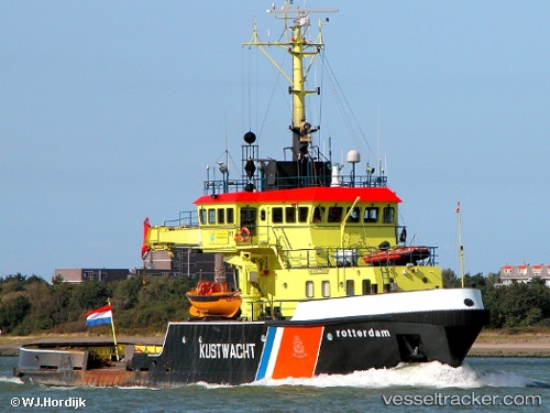
Vessel Rotterdam IMO: 8609888, MMSI: 244353000 Buoy Lighthouse Vessel
UTC, 51.56841, 3.41051, course: 332, speed: 8.5
UTC, 51.70650, 3.27957, course: 32, speed: 0.3
2026-02-05 15:26:05 UTC, 51.68147, 3.43769, course: 124, speed: 9.7
Live AIS position:
UTC. Near Domburg),
updated 2026-02-05 15:26:05 UTC.
Find the position of the vessel Rotterdam on the map. The latter are known coordinates and path.
marine traffic ship tracker show on live map
The current position of vessel Rotterdam is 51.68147 lat / 3.43769 lng. Updated: 2026-02-05 15:26:05 UTCCurrently sailing under the flag of Netherlands
Rotterdam built in 1987 year
Deadweight:
111 tDetails:
Last coordinates of the vessel:
UTC, 51.56306, 3.40614, course: 148, speed: 9UTC, 51.56841, 3.41051, course: 332, speed: 8.5
UTC, 51.70650, 3.27957, course: 32, speed: 0.3
2026-02-05 15:26:05 UTC, 51.68147, 3.43769, course: 124, speed: 9.7