 vesseltracker.com
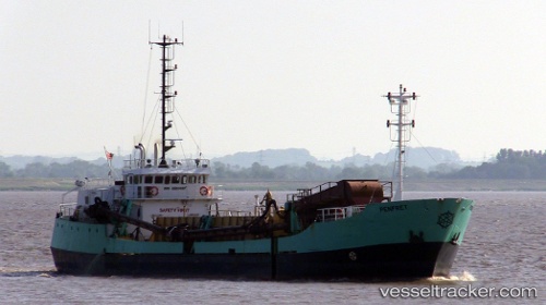
Vessel Penfret IMO: 8620387, MMSI: 235113112 Hopper Dredger
UTC, 51.55329, -2.98910, course: 256, speed: 0
UTC, 51.55335, -2.98909, course: 256, speed: 0
2026-01-30 02:16:47 UTC, 51.55167, -2.98833, course: -1, speed: 0
Live AIS position:
UTC. Near Newport),
updated 2026-01-30 02:16:47 UTC.
Find the position of the vessel Penfret on the map. The latter are known coordinates and path.
marine traffic ship tracker show on live map
The current position of vessel Penfret is 51.55167 lat / -2.98833 lng. Updated: 2026-01-30 02:16:47 UTCCurrently sailing under the flag of United Kingdom
Details:
Last coordinates of the vessel:
UTC, 51.55331, -2.98908, course: 256, speed: 0UTC, 51.55329, -2.98910, course: 256, speed: 0
UTC, 51.55335, -2.98909, course: 256, speed: 0
2026-01-30 02:16:47 UTC, 51.55167, -2.98833, course: -1, speed: 0