 vesseltracker.com
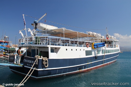
Vessel Porto Gramvusa IMO: 8647684, MMSI: 237233600 Passenger Ship
UTC, 35.51703, 23.63718, course: -1, speed: 0
UTC, 35.51703, 23.63720, course: -1, speed: 0
2026-02-01 17:00:34 UTC, 35.51703, 23.63720, course: -1, speed: 0
Live AIS position:
UTC. Near KISSAMOS),
updated 2026-02-01 17:00:34 UTC.
Find the position of the vessel Porto Gramvusa on the map. The latter are known coordinates and path.
marine traffic ship tracker show on live map
The current position of vessel Porto Gramvusa is 35.51703 lat / 23.63720 lng. Updated: 2026-02-01 17:00:34 UTCDetails:
Last coordinates of the vessel:
UTC, 35.51708, 23.63720, course: -1, speed: 0UTC, 35.51703, 23.63718, course: -1, speed: 0
UTC, 35.51703, 23.63720, course: -1, speed: 0
2026-02-01 17:00:34 UTC, 35.51703, 23.63720, course: -1, speed: 0