 vesseltracker.com
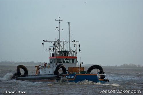
Vessel NJORD IMO: 8650409, MMSI: 376071000 Tug
UTC, -26.89738, -48.66913, course: 313, speed: 1.6
UTC, -26.89784, -48.66948, course: 334, speed: 0.8
2026-02-10 15:52:02 UTC, -26.89595, -48.67019, course: 348, speed: 0.7
Live AIS position:
UTC. Near Itajai),
updated 2026-02-10 15:52:02 UTC.
Find the position of the vessel NJORD on the map. The latter are known coordinates and path.
marine traffic ship tracker show on live map
The current position of vessel NJORD is -26.89595 lat / -48.67019 lng. Updated: 2026-02-10 15:52:02 UTCCurrently sailing under the flag of St Vincent and Grenadines
NJORD built in 1994 year
Deadweight:
0 tDetails:
Last coordinates of the vessel:
UTC, -26.89632, -48.67036, course: 314, speed: 2UTC, -26.89738, -48.66913, course: 313, speed: 1.6
UTC, -26.89784, -48.66948, course: 334, speed: 0.8
2026-02-10 15:52:02 UTC, -26.89595, -48.67019, course: 348, speed: 0.7