 vesseltracker.com
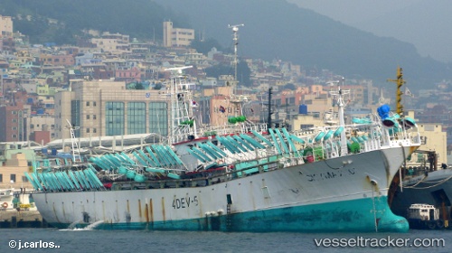
Vessel Skymax 101 IMO: 8662828, MMSI: 440038000 Fishing Vessel
UTC, -49.85066, -61.31468, course: 157, speed: 0.5
UTC, -49.83981, -61.30299, course: 156, speed: 0.6
2026-02-25 12:24:58 UTC, -49.80832, -61.28694, course: 173, speed: 0.4
Live AIS position:
UTC. 134 nm NW of Port San Carlos),
updated 2026-02-25 12:24:58 UTC.
Find the position of the vessel Skymax 101 on the map. The latter are known coordinates and path.
marine traffic ship tracker show on live map
The current position of vessel Skymax 101 is -49.80832 lat / -61.28694 lng. Updated: 2026-02-25 12:24:58 UTCDetails:
Last coordinates of the vessel:
UTC, -49.86248, -61.31670, course: 162, speed: 0.4UTC, -49.85066, -61.31468, course: 157, speed: 0.5
UTC, -49.83981, -61.30299, course: 156, speed: 0.6
2026-02-25 12:24:58 UTC, -49.80832, -61.28694, course: 173, speed: 0.4