 vesseltracker.com
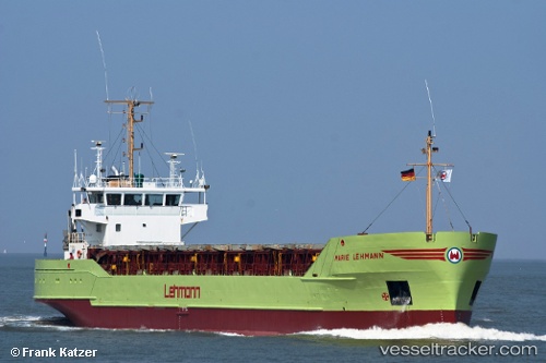
Vessel Marie b IMO: 8707783, MMSI: 304323000 General Cargo Ship
UTC, 51.31344, 3.82953, course: 342, speed: 4.2
UTC, 51.37894, 3.72900, course: 319, speed: 13.4
2026-03-06 19:58:36 UTC, 51.71981, 3.29293, course: 359, speed: 8
Live Vessel Marie b Analytics (details, animations, etc.)
Live AIS position: UTC. Near Hunsdon), updated 2026-03-06 19:58:36 UTC.Find the position of the vessel Marie b on the map. The latter are known coordinates and path.
marine traffic ship tracker show on live map
The current position of vessel Marie b is 51.71981 lat / 3.29293 lng. Updated: 2026-03-06 19:58:36 UTCCurrently sailing under the flag of Antigua Barbuda
Marie b built in 1987 year
Deadweight:
3017 tDetails:
Last coordinates of the vessel:
UTC, 51.16408, 3.77841, course: -1, speed: 0UTC, 51.31344, 3.82953, course: 342, speed: 4.2
UTC, 51.37894, 3.72900, course: 319, speed: 13.4
2026-03-06 19:58:36 UTC, 51.71981, 3.29293, course: 359, speed: 8