 vesseltracker.com
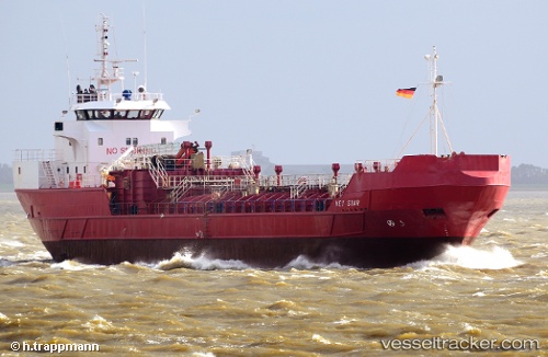
Vessel NOR STAR IMO: 8719102, MMSI: 630001042 Chemical Tanker
UTC, 61.60100, 4.95944, course: 323, speed: 11.3
UTC, 61.61015, 4.28547, course: 229, speed: 9.9
2026-02-23 11:36:35 UTC, 61.35082, 4.08692, course: 185, speed: 9.9
Live AIS position:
UTC. Near Gjoa),
updated 2026-02-23 11:36:35 UTC.
Find the position of the vessel NOR STAR on the map. The latter are known coordinates and path.
marine traffic ship tracker show on live map
The current position of vessel NOR STAR is 61.35082 lat / 4.08692 lng. Updated: 2026-02-23 11:36:35 UTCCurrently sailing under the flag of Guinea
Details:
Last coordinates of the vessel:
UTC, 61.58407, 5.00394, course: 274, speed: 0UTC, 61.60100, 4.95944, course: 323, speed: 11.3
UTC, 61.61015, 4.28547, course: 229, speed: 9.9
2026-02-23 11:36:35 UTC, 61.35082, 4.08692, course: 185, speed: 9.9