 vesseltracker.com
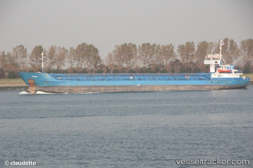
Vessel ROJA IMO: 8858099, MMSI: 422593600 General Cargo Ship
UTC, 43.23693, 50.89335, course: 304, speed: 6.2
UTC, 43.23693, 50.89335, course: 304, speed: 6.2
2026-02-05 10:11:08 UTC, 43.23693, 50.89335, course: 304, speed: 6.2
Live AIS position:
UTC. 27 nm SW of Aktau),
updated 2026-02-05 10:11:08 UTC.
Find the position of the vessel ROJA on the map. The latter are known coordinates and path.
marine traffic ship tracker show on live map
The current position of vessel ROJA is 43.23693 lat / 50.89335 lng. Updated: 2026-02-05 10:11:08 UTCCurrently sailing under the flag of Iran
ROJA built in 1984 year
Deadweight:
3230 tDetails:
Last coordinates of the vessel:
UTC, 43.13544, 51.15234, course: 302, speed: 5.2UTC, 43.23693, 50.89335, course: 304, speed: 6.2
UTC, 43.23693, 50.89335, course: 304, speed: 6.2
2026-02-05 10:11:08 UTC, 43.23693, 50.89335, course: 304, speed: 6.2