 vesseltracker.com
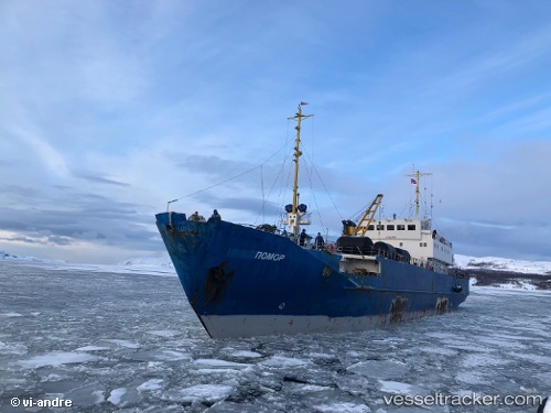
Vessel Pomor IMO: 8860468, MMSI: 273398570 Fish Carrier
UTC, 69.69008, 43.39800, course: 43, speed: 1.8
UTC, 69.69008, 43.39800, course: 43, speed: 1.8
2026-02-25 22:31:24 UTC, 69.82723, 43.41755, course: 53, speed: 1.9
Live AIS position:
UTC. 129 nm NW of Kolguyev Island),
updated 2026-02-25 22:31:24 UTC.
Find the position of the vessel Pomor on the map. The latter are known coordinates and path.
marine traffic ship tracker show on live map
The current position of vessel Pomor is 69.82723 lat / 43.41755 lng. Updated: 2026-02-25 22:31:24 UTCCurrently sailing under the flag of Russia
Details:
Last coordinates of the vessel:
UTC, 69.67169, 43.38652, course: 141, speed: 4UTC, 69.69008, 43.39800, course: 43, speed: 1.8
UTC, 69.69008, 43.39800, course: 43, speed: 1.8
2026-02-25 22:31:24 UTC, 69.82723, 43.41755, course: 53, speed: 1.9