 vesseltracker.com
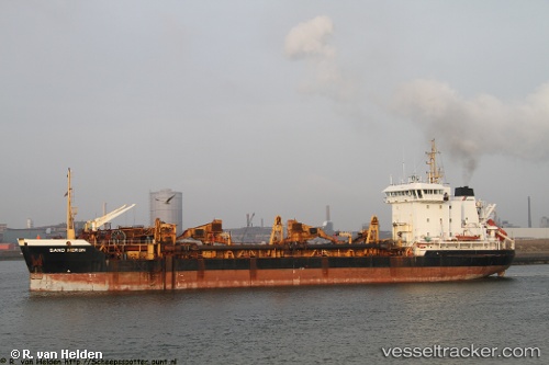
Vessel GD 3000 IMO: 8900701, MMSI: 447321000 Hopper Dredger
UTC, 16.99289, 82.32574, course: 319, speed: 1.5
UTC, 17.05383, 82.35928, course: 25, speed: 6.4
2026-01-18 12:26:21 UTC, 17.05246, 82.35841, course: 199, speed: 6.2
Live AIS position:
UTC. Near Kakinada),
updated 2026-01-18 12:26:21 UTC.
Find the position of the vessel GD 3000 on the map. The latter are known coordinates and path.
marine traffic ship tracker show on live map
The current position of vessel GD 3000 is 17.05246 lat / 82.35841 lng. Updated: 2026-01-18 12:26:21 UTCCurrently sailing under the flag of Kuwait
GD 3000 built in 1990 year
Deadweight:
5916 tDetails:
Last coordinates of the vessel:
UTC, 17.00883, 82.34100, course: 206, speed: 6.1UTC, 16.99289, 82.32574, course: 319, speed: 1.5
UTC, 17.05383, 82.35928, course: 25, speed: 6.4
2026-01-18 12:26:21 UTC, 17.05246, 82.35841, course: 199, speed: 6.2