 vesseltracker.com
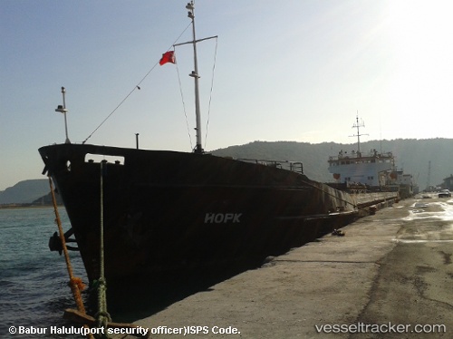
Vessel York IMO: 8935392, MMSI: 273340110 Multi Purpose Carrier
UTC, 39.65390, 52.89148, course: -1, speed: 6.4
UTC, 39.65390, 52.89148, course: -1, speed: 6.4
2026-01-21 23:26:43 UTC, 43.02711, 51.34242, course: 300, speed: 6.4
Live AIS position:
UTC. 17 nm SW of Kuryk),
updated 2026-01-21 23:26:43 UTC.
Find the position of the vessel York on the map. The latter are known coordinates and path.
marine traffic ship tracker show on live map
The current position of vessel York is 43.02711 lat / 51.34242 lng. Updated: 2026-01-21 23:26:43 UTCCurrently sailing under the flag of Russia
York built in 1978 year
Deadweight:
3201 tDetails:
Last coordinates of the vessel:
UTC, 39.65390, 52.89148, course: -1, speed: 6.4UTC, 39.65390, 52.89148, course: -1, speed: 6.4
UTC, 39.65390, 52.89148, course: -1, speed: 6.4
2026-01-21 23:26:43 UTC, 43.02711, 51.34242, course: 300, speed: 6.4