 vesseltracker.com
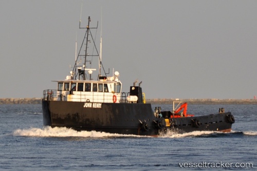
Vessel John Henry IMO: 8978174, MMSI: 367647270 Utility Vessel
UTC, 33.73545, -118.27113, course: 10, speed: 0
UTC, 33.73545, -118.27115, course: 7, speed: 0
2026-01-30 16:12:43 UTC, 33.73544, -118.27112, course: 8, speed: 0.1
Live AIS position:
UTC. Near Los Angeles),
updated 2026-01-30 16:12:43 UTC.
Find the position of the vessel John Henry on the map. The latter are known coordinates and path.
marine traffic ship tracker show on live map
The current position of vessel John Henry is 33.73544 lat / -118.27112 lng. Updated: 2026-01-30 16:12:43 UTCDetails:
Last coordinates of the vessel:
UTC, 33.73544, -118.27114, course: 7, speed: 0UTC, 33.73545, -118.27113, course: 10, speed: 0
UTC, 33.73545, -118.27115, course: 7, speed: 0
2026-01-30 16:12:43 UTC, 33.73544, -118.27112, course: 8, speed: 0.1