 vesseltracker.com
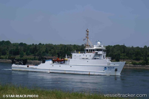
Vessel Noaa Nancy Foster IMO: 8993227, MMSI: 369912000 Research Vessel
UTC, 32.86060, -79.95998, course: -1, speed: 0.7
UTC, 32.86060, -79.95998, course: -1, speed: 0.7
2026-02-06 11:46:46 UTC, 32.86060, -79.95998, course: -1, speed: 0.7
Live AIS position:
UTC. Near Charleston Heights),
updated 2026-02-06 11:46:46 UTC.
Find the position of the vessel Noaa Nancy Foster on the map. The latter are known coordinates and path.
marine traffic ship tracker show on live map
The current position of vessel Noaa Nancy Foster is 32.86060 lat / -79.95998 lng. Updated: 2026-02-06 11:46:46 UTCDetails:
Last coordinates of the vessel:
UTC, 32.86059, -79.95994, course: -1, speed: 0.4UTC, 32.86060, -79.95998, course: -1, speed: 0.7
UTC, 32.86060, -79.95998, course: -1, speed: 0.7
2026-02-06 11:46:46 UTC, 32.86060, -79.95998, course: -1, speed: 0.7