 vesseltracker.com
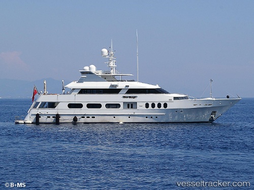
Vessel Never Enough IMO: 8999439, MMSI: 319731000 Service Ship
UTC, 18.45876, -66.09029, course: 190, speed: 0
UTC, 18.48049, -66.09801, course: 93, speed: 11.5
2026-02-18 16:32:33 UTC, 18.39375, -65.61603, course: 135, speed: 11.1
Live AIS position:
UTC. Near FAJARDO),
updated 2026-02-18 16:32:33 UTC.
Find the position of the vessel Never Enough on the map. The latter are known coordinates and path.
marine traffic ship tracker show on live map
The current position of vessel Never Enough is 18.39375 lat / -65.61603 lng. Updated: 2026-02-18 16:32:33 UTCCurrently sailing under the flag of Cayman Is
Details:
Last coordinates of the vessel:
UTC, 18.45874, -66.09029, course: 189, speed: 0UTC, 18.45876, -66.09029, course: 190, speed: 0
UTC, 18.48049, -66.09801, course: 93, speed: 11.5
2026-02-18 16:32:33 UTC, 18.39375, -65.61603, course: 135, speed: 11.1