 vesseltracker.com
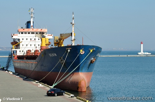
Vessel Derin IMO: 9001150, MMSI: 271000020 General Cargo Ship
UTC, 30.68316, 125.54226, course: -1, speed: 0.7
UTC, 30.68316, 125.54226, course: -1, speed: 0.7
2026-02-04 22:05:44 UTC, 30.68316, 125.54226, course: -1, speed: 0.7
Live AIS position:
UTC. 151 nm E of Lü-hua Shan),
updated 2026-02-04 22:05:44 UTC.
Find the position of the vessel Derin on the map. The latter are known coordinates and path.
marine traffic ship tracker show on live map
The current position of vessel Derin is 30.68316 lat / 125.54226 lng. Updated: 2026-02-04 22:05:44 UTCCurrently sailing under the flag of Turkey
Derin built in 1991 year
Deadweight:
8379 tDetails:
Last coordinates of the vessel:
UTC, 30.69271, 125.55420, course: -1, speed: 0.1UTC, 30.68316, 125.54226, course: -1, speed: 0.7
UTC, 30.68316, 125.54226, course: -1, speed: 0.7
2026-02-04 22:05:44 UTC, 30.68316, 125.54226, course: -1, speed: 0.7