 vesseltracker.com
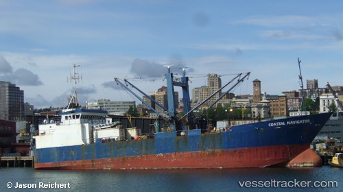
Vessel Coastal Navigator IMO: 9010498, MMSI: 368219000 Refrigerated Cargo Ship
UTC, 52.91778, -149.38643, course: 259, speed: 6.3
UTC, 52.83806, -149.85124, course: 271, speed: 7.3
2026-02-25 15:21:36 UTC, 52.80186, -150.11639, course: 253, speed: 6.7
Live AIS position:
UTC. 41 nm W of Kings Bromley),
updated 2026-02-25 15:21:36 UTC.
Find the position of the vessel Coastal Navigator on the map. The latter are known coordinates and path.
marine traffic ship tracker show on live map
The current position of vessel Coastal Navigator is 52.80186 lat / -150.11639 lng. Updated: 2026-02-25 15:21:36 UTCDetails:
Last coordinates of the vessel:
UTC, 52.95015, -149.04872, course: 267, speed: 7.4UTC, 52.91778, -149.38643, course: 259, speed: 6.3
UTC, 52.83806, -149.85124, course: 271, speed: 7.3
2026-02-25 15:21:36 UTC, 52.80186, -150.11639, course: 253, speed: 6.7