 vesseltracker.com
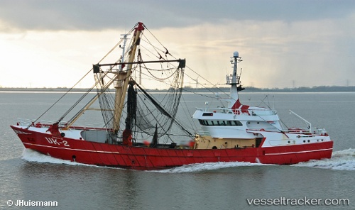
Vessel Uk 2 Adriaantje IMO: 9013907, MMSI: 244381000 Fishing Vessel
UTC, 53.18185, 5.41795, course: -1, speed: 0
UTC, 53.18185, 5.41792, course: 292, speed: 0
2026-02-12 07:51:05 UTC, 53.18183, 5.41798, course: 292, speed: 0
Live AIS position:
UTC. Near HARLINGEN),
updated 2026-02-12 07:51:05 UTC.
Find the position of the vessel Uk 2 Adriaantje on the map. The latter are known coordinates and path.
marine traffic ship tracker show on live map
The current position of vessel Uk 2 Adriaantje is 53.18183 lat / 5.41798 lng. Updated: 2026-02-12 07:51:05 UTCCurrently sailing under the flag of Netherlands
Uk 2 Adriaantje built in 1990 year
Details:
Last coordinates of the vessel:
UTC, 53.18189, 5.41794, course: -1, speed: 0UTC, 53.18185, 5.41795, course: -1, speed: 0
UTC, 53.18185, 5.41792, course: 292, speed: 0
2026-02-12 07:51:05 UTC, 53.18183, 5.41798, course: 292, speed: 0