 vesseltracker.com
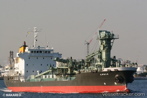
Vessel Shin Aki Maru IMO: 9015084, MMSI: 432844000 Cement Carrier
UTC, 34.13190, 136.87415, course: -1, speed: 14.3
UTC, 34.29895, 137.20029, course: -1, speed: 12.9
2026-02-28 22:56:37 UTC, 34.40752, 137.50386, course: -1, speed: 13.5
Live AIS position:
UTC. 19 nm S of Kosai),
updated 2026-02-28 22:56:37 UTC.
Find the position of the vessel Shin Aki Maru on the map. The latter are known coordinates and path.
marine traffic ship tracker show on live map
The current position of vessel Shin Aki Maru is 34.40752 lat / 137.50386 lng. Updated: 2026-02-28 22:56:37 UTCDetails:
Last coordinates of the vessel:
UTC, 33.71810, 136.31471, course: 50, speed: 14.2UTC, 34.13190, 136.87415, course: -1, speed: 14.3
UTC, 34.29895, 137.20029, course: -1, speed: 12.9
2026-02-28 22:56:37 UTC, 34.40752, 137.50386, course: -1, speed: 13.5