 vesseltracker.com
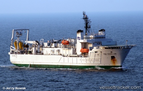
Vessel DNEX PACIFIC LINK IMO: 9017824, MMSI: 525900077 Cable-Layer
UTC, 1.18183, 103.98017, course: 63, speed: 0.1
UTC, 1.18183, 103.98017, course: 34, speed: 0.2
2026-02-25 15:54:51 UTC, 1.18167, 103.98017, course: 54, speed: 0.1
Live AIS position:
UTC. Near BATU AMPAR),
updated 2026-02-25 15:54:51 UTC.
Find the position of the vessel DNEX PACIFIC LINK on the map. The latter are known coordinates and path.
marine traffic ship tracker show on live map
The current position of vessel DNEX PACIFIC LINK is 1.18167 lat / 103.98017 lng. Updated: 2026-02-25 15:54:51 UTCCurrently sailing under the flag of Indonesia
DNEX PACIFIC LINK built in 1993 year
Deadweight:
6597 tDetails:
Last coordinates of the vessel:
UTC, 1.18183, 103.98017, course: 26, speed: 0UTC, 1.18183, 103.98017, course: 63, speed: 0.1
UTC, 1.18183, 103.98017, course: 34, speed: 0.2
2026-02-25 15:54:51 UTC, 1.18167, 103.98017, course: 54, speed: 0.1