 vesseltracker.com
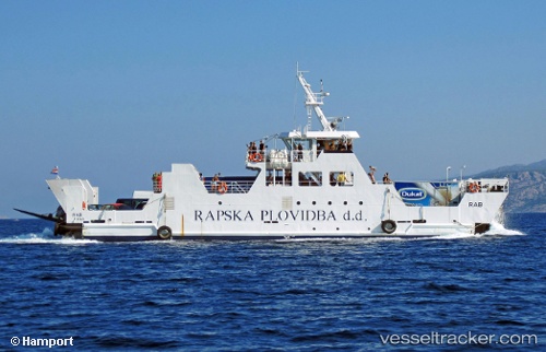
Vessel Rab IMO: 9030656, MMSI: 238218640 Passenger Ro Ro Cargo Ship
UTC, 43.41667, 16.50833, course: -1, speed: 7
UTC, 43.41667, 16.50833, course: -1, speed: 7
2026-02-25 09:39:07 UTC, 43.38500, 16.55500, course: -1, speed: 0
Live AIS position:
UTC. Near Supetar),
updated 2026-02-25 09:39:07 UTC.
Find the position of the vessel Rab on the map. The latter are known coordinates and path.
marine traffic ship tracker show on live map
The current position of vessel Rab is 43.38500 lat / 16.55500 lng. Updated: 2026-02-25 09:39:07 UTCDetails:
Last coordinates of the vessel:
UTC, 43.50154, 16.39084, course: -1, speed: 7.4UTC, 43.41667, 16.50833, course: -1, speed: 7
UTC, 43.41667, 16.50833, course: -1, speed: 7
2026-02-25 09:39:07 UTC, 43.38500, 16.55500, course: -1, speed: 0