 vesseltracker.com
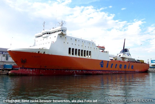
Vessel Drujba IMO: 9031698, MMSI: 207277000 Passenger Ro Ro Cargo Ship
UTC, 41.64709, 41.65566, course: 259, speed: 0
UTC, 41.64705, 41.65560, course: 259, speed: 0
2026-02-17 00:17:00 UTC, 41.71688, 41.33350, course: 279, speed: 15.3
Live AIS position:
UTC. 15 nm W of Batumi),
updated 2026-02-17 00:17:00 UTC.
Find the position of the vessel Drujba on the map. The latter are known coordinates and path.
marine traffic ship tracker show on live map
The current position of vessel Drujba is 41.71688 lat / 41.33350 lng. Updated: 2026-02-17 00:17:00 UTCDetails:
Last coordinates of the vessel:
UTC, 41.64707, 41.65560, course: 259, speed: 0UTC, 41.64709, 41.65566, course: 259, speed: 0
UTC, 41.64705, 41.65560, course: 259, speed: 0
2026-02-17 00:17:00 UTC, 41.71688, 41.33350, course: 279, speed: 15.3