.
vessel Falali IMO: 9036741, General Cargo Ship
vesseltracker.com
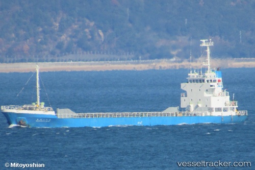
Vessel Falali IMO: 9036741, MMSI: 511822000 General Cargo Ship

callsign: T8A2948
size: 12x73

Live AIS position: UTC. Near GRANDE ISLAND), updated 2023-12-07 00:41:53 UTC.

Find the position of the vessel Falali on the map. The latter are known coordinates and path.

marine traffic ship tracker show on live map

The current position of vessel Falali is 14.81865 lat / 120.29560 lng. Updated: 2023-12-07 00:41:53 UTC
Details:


Last coordinates of the vessel:
2023-12-07 00:41:53 UTC, 14.81865, 120.29560, course: -1, speed: 0


Most frequent ports a vessels calls at Falali (511822000):

Olongapo, traffic: 12
Subic Bay, traffic: 5

Link to the map:


Find another ship

Falali (511822000) last ports (portcalls and passsages)

Olongapo | 2023-12-07 03:43:29
Olongapo | 2023-12-03 01:54:37
Olongapo | 2023-11-27 09:13:46
Olongapo | 2023-11-23 07:31:38
Olongapo | 2023-11-18 03:38:00
Olongapo | 2023-11-14 03:06:17
Olongapo | 2023-11-10 02:21:29
Olongapo | 2023-11-06 00:52:16
Subic Bay | 2023-11-05 23:18:59
Subic Bay | 2023-07-29 00:53:15
Olongapo | 2023-07-25 07:32:13
Olongapo | 2023-07-21 00:50:56
Subic Bay | 2023-07-20 22:28:15
Olongapo | 2022-12-29 03:06:57
Subic Bay | 2022-12-28 23:15:40
Olongapo | 2022-09-13 04:58:41
Subic Bay | 2022-09-13 01:52:42