 vesseltracker.com
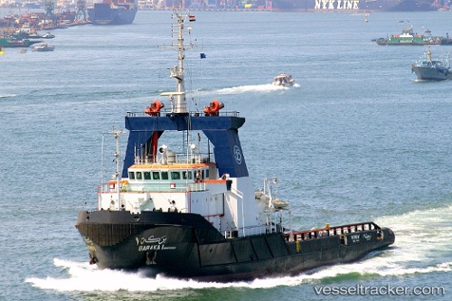
Vessel Baraka 1 IMO: 9038361, MMSI: 622123201 Tug
UTC, 30.58593, 32.27332, course: 341, speed: 0
UTC, 30.58500, 32.27333, course: -1, speed: 0
2026-02-09 03:28:38 UTC, 30.58500, 32.27333, course: -1, speed: 0
Live AIS position:
UTC. Near ISMAILIA),
updated 2026-02-09 03:28:38 UTC.
Find the position of the vessel Baraka 1 on the map. The latter are known coordinates and path.
marine traffic ship tracker show on live map
The current position of vessel Baraka 1 is 30.58500 lat / 32.27333 lng. Updated: 2026-02-09 03:28:38 UTCCurrently sailing under the flag of Egypt
Baraka 1 built in 1993 year
Deadweight:
2320 tDetails:
Last coordinates of the vessel:
UTC, 30.58590, 32.27333, course: 341, speed: 0.1UTC, 30.58593, 32.27332, course: 341, speed: 0
UTC, 30.58500, 32.27333, course: -1, speed: 0
2026-02-09 03:28:38 UTC, 30.58500, 32.27333, course: -1, speed: 0