 vesseltracker.com
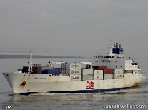
Vessel Dole Europa IMO: 9046514, MMSI: 311296000 Refrigerated Cargo Ship
UTC, 31.32913, -47.22571, course: 58, speed: 16
UTC, 31.38549, -47.12519, course: 58, speed: 16.3
2026-01-20 05:27:43 UTC, 31.54712, -46.82530, course: 60, speed: 15.8
Live AIS position:
UTC. 229 nm W of Girard),
updated 2026-01-20 05:27:43 UTC.
Find the position of the vessel Dole Europa on the map. The latter are known coordinates and path.
marine traffic ship tracker show on live map
The current position of vessel Dole Europa is 31.54712 lat / -46.82530 lng. Updated: 2026-01-20 05:27:43 UTCCurrently sailing under the flag of Bahamas
Details:
Last coordinates of the vessel:
UTC, 31.11193, -47.62206, course: 58, speed: 15.8UTC, 31.32913, -47.22571, course: 58, speed: 16
UTC, 31.38549, -47.12519, course: 58, speed: 16.3
2026-01-20 05:27:43 UTC, 31.54712, -46.82530, course: 60, speed: 15.8