 vesseltracker.com
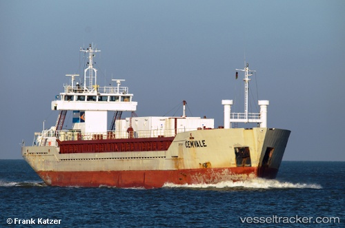
Vessel Cemvale IMO: 9048287, MMSI: 212109000 Cement Carrier
UTC, 50.49929, -3.45473, course: 168, speed: 0.3
UTC, 50.45409, -3.42529, course: 158, speed: 6.9
2026-02-07 07:25:00 UTC, 50.19738, -3.47587, course: 226, speed: 7.2
Live AIS position:
UTC. Near River Dart),
updated 2026-02-07 07:25:00 UTC.
Find the position of the vessel Cemvale on the map. The latter are known coordinates and path.
marine traffic ship tracker show on live map
The current position of vessel Cemvale is 50.19738 lat / -3.47587 lng. Updated: 2026-02-07 07:25:00 UTCCurrently sailing under the flag of Cyprus
Cemvale built in 1992 year
Deadweight:
4257 tDetails:
Last coordinates of the vessel:
UTC, 50.49937, -3.45479, course: 198, speed: 0.6UTC, 50.49929, -3.45473, course: 168, speed: 0.3
UTC, 50.45409, -3.42529, course: 158, speed: 6.9
2026-02-07 07:25:00 UTC, 50.19738, -3.47587, course: 226, speed: 7.2