 vesseltracker.com
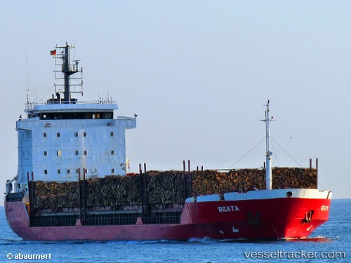
Vessel Beata IMO: 9053828, MMSI: 255805882 Multi Purpose Carrier
UTC, 57.26762, 16.47518, course: 128, speed: 0
UTC, 57.32290, 16.84247, course: 50, speed: 10
2026-02-05 15:26:00 UTC, 57.37216, 17.22975, course: 123, speed: 10.9
Live AIS position:
UTC. Near Grankullavik),
updated 2026-02-05 15:26:00 UTC.
Find the position of the vessel Beata on the map. The latter are known coordinates and path.
marine traffic ship tracker show on live map
The current position of vessel Beata is 57.37216 lat / 17.22975 lng. Updated: 2026-02-05 15:26:00 UTCCurrently sailing under the flag of Portugal
Beata built in 1994 year
Deadweight:
6918 tDetails:
Last coordinates of the vessel:
UTC, 57.26761, 16.47522, course: 128, speed: 0UTC, 57.26762, 16.47518, course: 128, speed: 0
UTC, 57.32290, 16.84247, course: 50, speed: 10
2026-02-05 15:26:00 UTC, 57.37216, 17.22975, course: 123, speed: 10.9