 vesseltracker.com
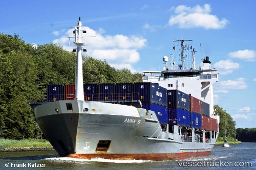
Vessel ANNA G. IMO: 9061291, MMSI: 304914000 Container Ship
UTC, 51.45759, 3.52150, course: 337, speed: 12.7
UTC, 51.73773, 3.26805, course: 3, speed: 11.3
2026-02-10 11:50:21 UTC, 52.06711, 3.41454, course: 14, speed: 10.5
Live AIS position:
UTC. 17 nm N of Hunsdon),
updated 2026-02-10 11:50:21 UTC.
Find the position of the vessel ANNA G. on the map. The latter are known coordinates and path.
marine traffic ship tracker show on live map
The current position of vessel ANNA G. is 52.06711 lat / 3.41454 lng. Updated: 2026-02-10 11:50:21 UTCCurrently sailing under the flag of Antigua and Barbuda
ANNA G. built in 1994 year
Deadweight:
5330 tDetails:
Last coordinates of the vessel:
UTC, 51.37146, 4.11740, course: 261, speed: 9.9UTC, 51.45759, 3.52150, course: 337, speed: 12.7
UTC, 51.73773, 3.26805, course: 3, speed: 11.3
2026-02-10 11:50:21 UTC, 52.06711, 3.41454, course: 14, speed: 10.5