 vesseltracker.com
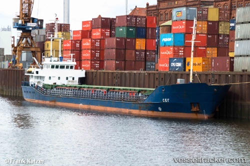
Vessel LUNA B IMO: 9066045, MMSI: 211890660 General Cargo
UTC, 48.42667, -5.66167, course: -1, speed: 8
UTC, 48.70423, -5.62405, course: 26, speed: 10
2026-03-01 15:50:22 UTC, 48.81962, -5.35178, course: -1, speed: 8.1
Live AIS position:
UTC. 11 nm NE of Ile D’Ouessant),
updated 2026-03-01 15:50:22 UTC.
Find the position of the vessel LUNA B on the map. The latter are known coordinates and path.
marine traffic ship tracker show on live map
The current position of vessel LUNA B is 48.81962 lat / -5.35178 lng. Updated: 2026-03-01 15:50:22 UTCCurrently sailing under the flag of Germany
Details:
Last coordinates of the vessel:
UTC, 48.14758, -5.52310, course: -1, speed: 9.1UTC, 48.42667, -5.66167, course: -1, speed: 8
UTC, 48.70423, -5.62405, course: 26, speed: 10
2026-03-01 15:50:22 UTC, 48.81962, -5.35178, course: -1, speed: 8.1