 vesseltracker.com
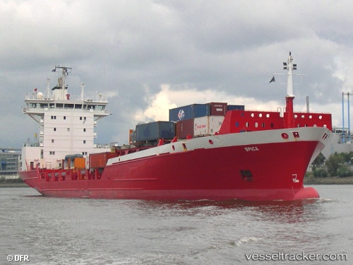
Vessel NANTO IMO: 9083043, MMSI: 276870000 Container Ship
UTC, 28.15024, -15.41287, course: -1, speed: 0
UTC, 28.15029, -15.41287, course: 220, speed: 0
2026-02-26 11:57:51 UTC, 28.15028, -15.41285, course: 219, speed: 0
Live AIS position:
UTC. Near Las Palmas),
updated 2026-02-26 11:57:51 UTC.
Find the position of the vessel NANTO on the map. The latter are known coordinates and path.
marine traffic ship tracker show on live map
The current position of vessel NANTO is 28.15028 lat / -15.41285 lng. Updated: 2026-02-26 11:57:51 UTCCurrently sailing under the flag of Estonia
Details:
Last coordinates of the vessel:
UTC, 28.15026, -15.41286, course: 219, speed: 0UTC, 28.15024, -15.41287, course: -1, speed: 0
UTC, 28.15029, -15.41287, course: 220, speed: 0
2026-02-26 11:57:51 UTC, 28.15028, -15.41285, course: 219, speed: 0