 vesseltracker.com
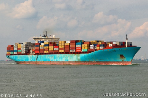
Vessel Maersk Kleven IMO: 9085546, MMSI: 636018912 Container Ship
UTC, 31.93348, -80.25789, course: 303, speed: 1.5
UTC, 31.95714, -80.23580, course: 263, speed: 1.2
2026-02-21 05:39:49 UTC, 31.96079, -80.20004, course: 289, speed: 1.3
Live AIS position:
UTC. 31 nm SE of Hilton Head Island),
updated 2026-02-21 05:39:49 UTC.
Find the position of the vessel Maersk Kleven on the map. The latter are known coordinates and path.
marine traffic ship tracker show on live map
The current position of vessel Maersk Kleven is 31.96079 lat / -80.20004 lng. Updated: 2026-02-21 05:39:49 UTCCurrently sailing under the flag of Liberia
Maersk Kleven built in 1996 year
Deadweight:
84900 tDetails:
Last coordinates of the vessel:
UTC, 32.21212, -79.82541, course: 234, speed: 12UTC, 31.93348, -80.25789, course: 303, speed: 1.5
UTC, 31.95714, -80.23580, course: 263, speed: 1.2
2026-02-21 05:39:49 UTC, 31.96079, -80.20004, course: 289, speed: 1.3