 vesseltracker.com
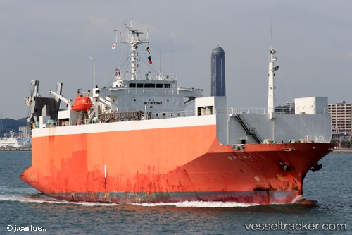
Vessel HARMONI MAS 8 IMO: 9100358, MMSI: 525201455 Ro-Ro Cargo Ship
UTC, -6.17950, 107.93482, course: -1, speed: 9.7
UTC, -6.17950, 107.93482, course: -1, speed: 9.7
2026-02-25 04:33:04 UTC, -6.17950, 107.93482, course: -1, speed: 9.7
Live AIS position:
UTC. 14 nm N of Sukatani),
updated 2026-02-25 04:33:04 UTC.
Find the position of the vessel HARMONI MAS 8 on the map. The latter are known coordinates and path.
marine traffic ship tracker show on live map
The current position of vessel HARMONI MAS 8 is -6.17950 lat / 107.93482 lng. Updated: 2026-02-25 04:33:04 UTCCurrently sailing under the flag of Indonesia
HARMONI MAS 8 built in 1994 year
Deadweight:
3751 tDetails:
Last coordinates of the vessel:
UTC, -6.22780, 107.90939, course: -1, speed: 0UTC, -6.17950, 107.93482, course: -1, speed: 9.7
UTC, -6.17950, 107.93482, course: -1, speed: 9.7
2026-02-25 04:33:04 UTC, -6.17950, 107.93482, course: -1, speed: 9.7