 vesseltracker.com
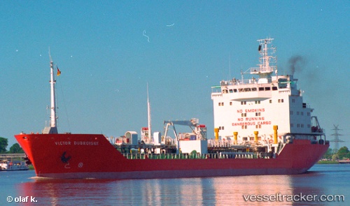
Vessel Wila IMO: 9100774, MMSI: 636017432 Chemical Oil Products Tanker
UTC, -13.80462, 144.93887, course: -1, speed: 23.1
UTC, -45.16573, -60.34537, course: 302, speed: 2.5
UTC, -45.16573, -60.34537, course: 302, speed: 2.5
2026-02-07 13:21:51 UTC, -45.16573, -60.34537, course: 302, speed: 2.5
Live AIS position:
UTC. 233 nm SE of Rawson),
updated 2026-02-07 13:21:51 UTC.
Find the position of the vessel Wila on the map. The latter are known coordinates and path.
marine traffic ship tracker show on live map
The current position of vessel Wila is -45.16573 lat / -60.34537 lng. Updated: 2026-02-07 13:21:51 UTCCurrently sailing under the flag of Liberia
Wila built in 1997 year
Deadweight:
8055 tDetails:
Last coordinates of the vessel:
UTC, -13.80462, 144.93887, course: -1, speed: 23.1UTC, -13.80462, 144.93887, course: -1, speed: 23.1
UTC, -45.16573, -60.34537, course: 302, speed: 2.5
UTC, -45.16573, -60.34537, course: 302, speed: 2.5
2026-02-07 13:21:51 UTC, -45.16573, -60.34537, course: 302, speed: 2.5